


la Roche des Nans

tigrou31
User
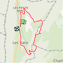

Length
7.4 km

Max alt
884 m

Uphill gradient
283 m
Km-Effort
11.2 km

Min alt
655 m

Downhill gradient
274 m
Boucle
No
Creation date :
2019-09-28 08:12:35.424
Updated on :
2019-09-28 11:03:34.343
2h50
Difficulty : Easy

FREE GPS app for hiking
 SityTrail
IGN / Geographical institutes
SityTrail Plus
The world is yours!
About
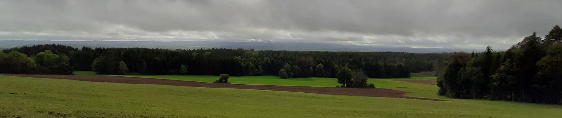
Trail Walking of 7.4 km to be discovered at Bourgogne-Franche-Comté, Jura, Les Nans. This trail is proposed by tigrou31.
Photos

Positioning
Country:
France
Region :
Bourgogne-Franche-Comté
Department/Province :
Jura
Municipality :
Les Nans
Location:
Unknown
Start:(Dec)
Start:(UTM)
726956 ; 5186915 (31T) N.
Comments